The weather today was a complete change from the previous day's storm. The forecast was for clear skies and sunshine and it did not disappoint. I woke at 6:00 am in anticipation of a slightly later departure since the day was only scheduled for 120 miles and only 4,000 feet of climbing. Almost all of it in the first 50 miles and the rest down hill.
Before I could ride however, I needed to clean my bike from the ride in yesterday's storm. My chain was completely dry and there was grit and grime all over the bike. I also found that I got my first flat on the front tire. I did plan ahead and brought degreaser, chain lube, bike cleaning fluid and disposable shop towels as well as extra tubes and all the tools I would need along the journey. (Most of this was carried in the support vehicle.)
I quickly cleaned and lubed my bike behind the hotel, changed the tube and was ready to go. While I was performing the bike maintenance, I noticed that my brake pads had become extremely worn down due to the grit and sand from the rain and trying hard to control my descents. I didn't think much of it at the time, but this would soon become a problem.
Meantime, my wife and daughter had talked to the manager of the Holiday Inn Express, where we were staying and explained what I was doing. We left them some postcards that advertised the Inspiration Ride along with some bicycle bells that had the QR code for the donation page to distribute. The manager was so excited bout it that he took up a collection from his employees and made a donation. Before I departed for the day, we went outside and filmed a promotion video for the YouTube channel with the hotel staff. (Oh, they also gave us a discount on the room. Yay!)
I was finally able to start riding by 9:00 am and headed off towards Joshua Tree National Park. Then the first challenge began with a climb of nearly 10 miles averaging a steady 6% grade. Despite the previous days long ride, I had surprisingly fresh legs for the climb and got to the summit in about an hour including a brief photo opportunity at the park entrance sign.
Then things got interesting. I initially wanted to take a picture near the "Skull Rock" formation which was a side detour from the main road. My family had already drove ahead and were waiting for me. When I got to the crossroad, to divert to "Skull Rock", I didn't see any signs indicating how far it was. I had just made the summit and the main road headed down hill while the side road continued uphill. I didn't know how far and it was not indicated on my GPS map. I didn't relish going too many miles off coarse just to have to climb back. I also didn't have cell phone service in the park, so I couldn't reach my family to find out how far I needed to go.
I made the decision to just continue on the main road and skip the detour to "Skull Rock". I figured that when I didn't show up in a reasonable time, my family would backtrack and meet me along the route. (Not my finest decision.)
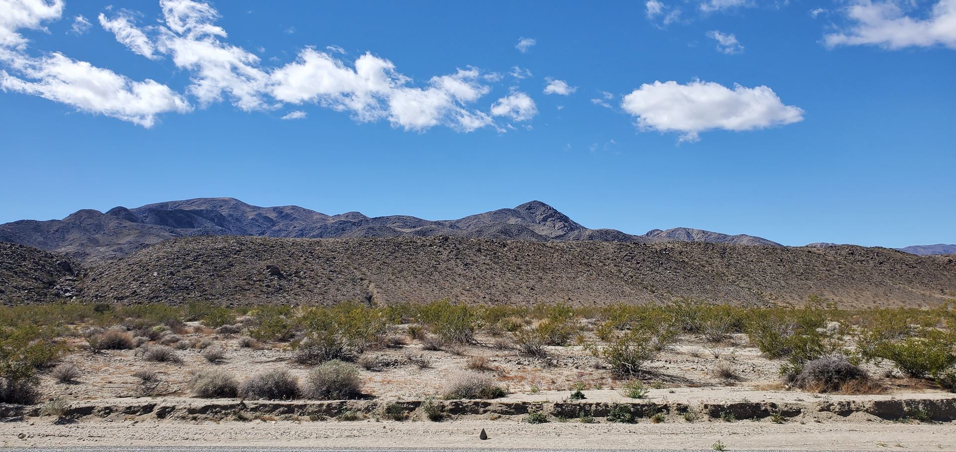
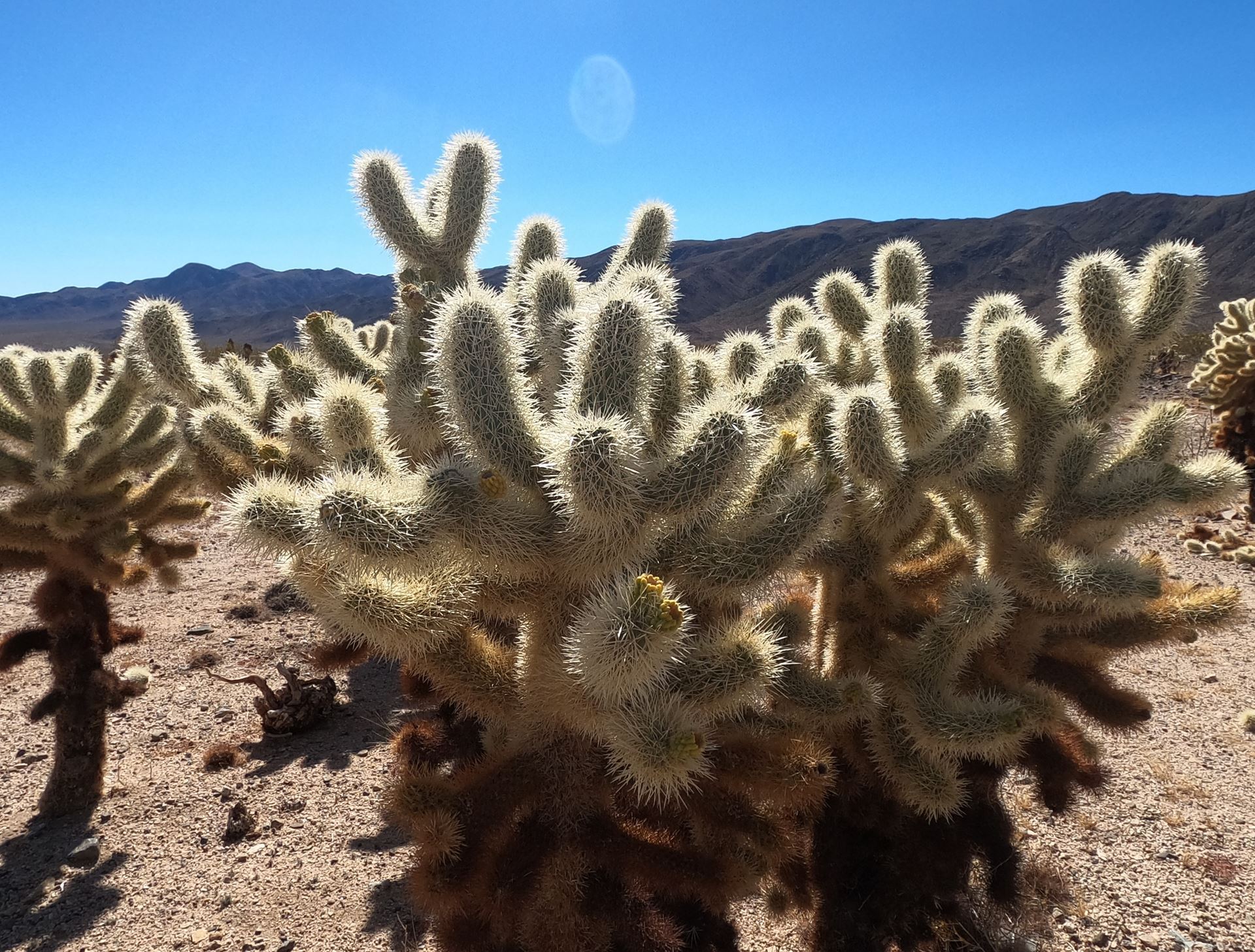
I began descending for the next 13 miles along some of the most spectacular scenery the desert has to offer. I passed Joshua Tree groves, (duh) Teddy-Bear Cholla groves, and Ocotillo groves, Ironwood groves, and Palo Verde trees. I took many breaks to film the plants for the video and to delay my time in hopes that my family would catch up to me.
 Mesquite bushes in Joshua Tree National Park
As I began climbing the second major climb of the day, my sister, niece, and daughter caught up to me. I inquired about my wife and they said she was still waiting when they had left. We tried calling but still didn't have phone service. They agreed to go back to find her and said they'd catch up to me soon. I continued to climb and they went back. About 30 minutes later, they caught me again and asked if my wife had caught up to me. They said they saw a vehicle that looked like hers going the other direction. I told them she hasn't come by and I was really beginning to worry. They said they would go ahead to the Cottonwood Springs Ranger Station and see if they could reach someone to help or get phone service. I continued on as well and soon met up again, but still no sign of my wife.
 Teddy Bear Cholla Cactus
I continued on out of the park and a long 7 mile descent over very rough pavement to reach the Interstate 10 and finally get phone service. Due to the rough road, I had to apply more pressure to my brakes and found that they were getting weaker. (Not a good sign).
The next 70 miles were along the Interstate 10 shoulder where it is legal to ride a bike because there are no other alternative routes. I called my wife as soon as I had service, but it went straight to voicemail. I left a message as to my location and direction and continued on. Next stop was Chiriaco Summit where I took a refuel break and tried calling my wife again. Still no contact and worry was taking hold. I continued for another 10 miles and pulled over at an exit when my phone rang. My daughter called and said they had spoken to my wife and she was okay. I immediately called her and was so relieved to hear her voice. I apologized for not continuing to the rendezvous point and was just glad that everything turned out alright, despite the worry for the both of us. At this point she also had just passed me on the Interstate and was heading to Blythe to check in to the hotel. Since it was still about 40 miles away for me, I told her I would be there in a couple of hours.
Now, riding on the side of the Interstate is very nerve wracking. The shoulder is 8 - 10 feet wide with a rumble strip separating the lanes of traffic and the shoulder. (a rumble strip is divots carved into the asphalt that make a noise and shake your vehicle to alert the driver they are drifting out of the lane.) Rumble strips are not bike friendly either. In California, the shoulder surface ranges from very smooth and clean to chip seal rough and filled with gravel and debris. I often found that I had to weave across the shoulder to dodge pieces of broken tires and other debris all while trying to stay as far to the right as possible. My bike radar was continually going so I was just ignoring it and kept one eye on my rear view mirror and the other eye on my path of travel. Oh yeah, the noise of the traffic travelling at over 70 miles an hour becomes deafening. Needless to say, it was not a pleasant experience. The upside was that there were no steep climbs on the Interstate. (nothing greater than 2%)
I went another twenty miles and pulled over at an exit to call my wife to find out if she got to the hotel and let her know my estimated arrival time. While I was speaking to her, there was a couple pulled over trying to secure their bicycles on the bike rack on their car. The husband was struggling to get them tied down. I asked them if they'd like some help and he explained that the second bike kept rising up due to the wind at high speed. I examined how they were secured and showed him how the bikes should be secured to each other as well as secured to the bike rack. I secured their bikes and then they asked me how I came to be out here on the Interstate. I explained my Inspiration Ride to them and they were so thrilled to hear about it and so grateful for the assistance that they promised to donate when they got to the hotel. They were on their way home to Colorado and still had another day to drive.
I rode the last twenty miles to Blythe and arrived just before sunset. It was a long day despite the distance and an emotional journey that also drained me physically. I also forget to mention, the bright sunshine of the day left me with quite a sunburn as I did forget to pack the sunscreen. I would pay for that mistake for the next two weeks.
After showering and getting dinner, I spent the next hour and a half uploading, editing and posting the daily video. By the time my head hit the pillow, I was asleep immediately. Tomorrow would be an even bigger day.
Watch the Full Video Here: https://youtu.be/XpJHeQcvMPI
Donate here: https://www.valleychildrens.org/foundation/cycling-across-america
Check out my activity on Strava: https://strava.app.link/Xhst1DR7bzb
